


leutasch

Bernardb44
User

Length
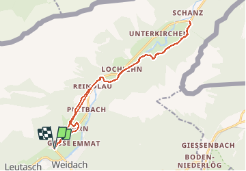
17.7 km

Max alt
1125 m

Uphill gradient
235 m
Km-Effort
21 km

Min alt
1033 m

Downhill gradient
233 m
Boucle
Yes
Creation date :
2020-02-18 09:07:09.735
Updated on :
2020-02-18 19:12:43.801
4h39
Difficulty : Easy

FREE GPS app for hiking
 SityTrail
IGN / Geographical institutes
SityTrail Plus
The world is yours!
About
Trail Walking of 17.7 km to be discovered at Tyrol, Bezirk Innsbruck-Land, Gemeinde Leutasch. This trail is proposed by Bernardb44.
Positioning
Country:
Austria
Region :
Tyrol
Department/Province :
Bezirk Innsbruck-Land
Municipality :
Gemeinde Leutasch
Location:
Unknown
Start:(Dec)
Start:(UTM)
662940 ; 5249250 (32T) N.
Comments